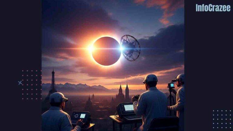
‘Space Umbrella’ Satellite Snaps Jaw-Dropping First Images of Earth’s Forests
Imagine a giant umbrella floating in space, peering through clouds and treetops to reveal the hidden secrets of Earth’s forests. That’s exactly what the European Space Agency’s (ESA) Biomass satellite, nicknamed the “space umbrella,” is doing! Launched in April 2025, this British-built marvel has just sent back its first stunning images of our planet’s forests, and they’re nothing short of amazing. At infocrazee, we’re thrilled to share how this game-changing tech is helping us understand our world like never before.
What’s the ‘Space Umbrella’ All About?
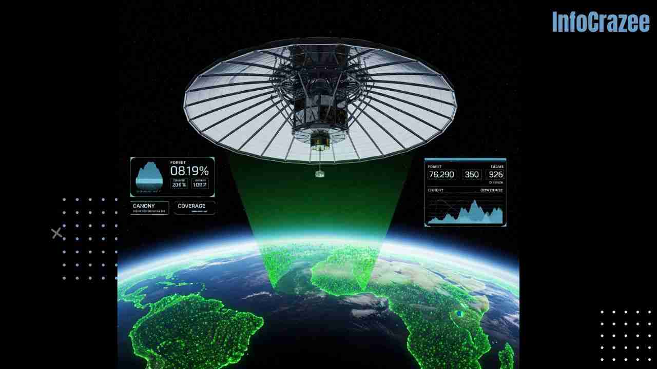
The Biomass satellite isn’t your average spacecraft. It’s equipped with a massive 12-meter antenna that unfurls like an umbrella in orbit, earning its catchy nickname. This high-tech tool uses a special P-band radar to “see” through forest canopies and clouds, capturing detailed 3D images of trees from 413 miles above Earth. Unlike older satellites that only skimmed the surface of forests, Biomass dives deep, measuring the height, density, and mass of trees to figure out how much carbon they store.
- Why it matters: Forests are Earth’s “lungs,” soaking up billions of tons of carbon to fight climate change. Knowing exactly how much carbon they hold helps scientists predict future climate shifts.
- Cool fact: The satellite’s radar has a super-long wavelength (about 70 cm), acting like a CT scan for forests, spotting trunks and branches hidden under thick canopies.
First Images: A Peek into Earth’s Green Heart
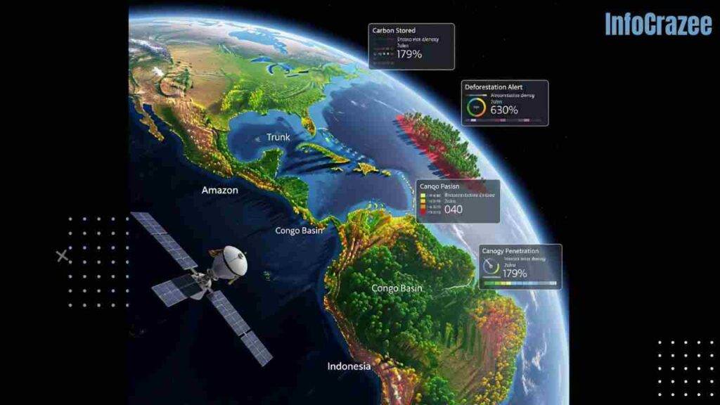
The first images from Biomass, released this week, focus on the Amazon rainforest, Congo Basin, and Indonesian forests. They’re not just pretty pictures—they’re packed with data that scientists are buzzing about. Picture this: vibrant, layered maps showing every level of a forest, from towering treetops to sturdy trunks. These snapshots reveal how much wood (and carbon) is tucked away in some of the world’s most remote jungles.
- Amazon rainforest: The images show dense, untouched patches alongside areas scarred by deforestation, highlighting the urgent need for conservation.
- Congo Basin: Biomass uncovered thick forest layers that store massive amounts of carbon, even in cloudy regions where older satellites struggled.
- Indonesia: The satellite spotted illegal logging under the canopy, which planes often miss, offering new ways to catch deforestation in action.
Dr. Paul Bate, head of the UK Space Agency, couldn’t hide his excitement: “These images are a big deal. We’re finally getting a clear picture of forests we could never reach on foot. It’s like having X-ray vision for the planet!”
Why This Matters to You
You might be wondering, “Okay, cool satellite, but how does this affect me?” Great question! Forests do more than just look nice—they keep our air clean, regulate the climate, and support millions of species. The Biomass mission is giving us the tools to protect them better. Here’s what these images mean for the real world:
- Smarter conservation: Governments and organizations can use these maps to pinpoint where forests need protection most, saving time and money.
- Fighting climate change: By knowing how much carbon forests store, we can make better plans to cut emissions and slow global warming.
- Catching illegal loggers: Biomass’s ability to see hidden deforestation could help crack down on illegal activity, keeping forests standing longer.
What’s Next for the Space Umbrella?
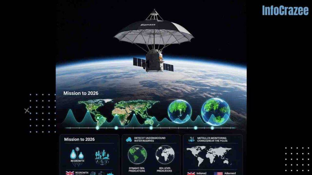
The Biomass satellite is just getting started on its five-year mission. It’s now fully unfolded and operational, ready to churn out more data. Scientists expect a full 3D map of tropical forests by late 2026, with updates every nine months to track changes like deforestation or regrowth. Plus, the satellite isn’t only about trees—it’ll also map underground water sources in deserts and monitor ice sheets. Talk about multitasking!
- Timeline: First global forest map in 17 months, then new maps every nine months.
- Bonus missions: Finding new water sources and studying ice sheets to predict sea level rise.
- Fun fact: The satellite was built in Stevenage, UK, with a giant antenna crafted by U.S. experts from L3Harris Technologies. It’s a true team effortvv
How You Can Get Involved
Feeling inspired by these incredible images? You don’t need a satellite to help Earth’s forests!
- Support conservation groups: Donate to organizations like the Rainforest Foundation or plant trees through programs like One Tree Planted.
- Reduce paper waste: Go digital where you can, and recycle to ease the pressure on forests.
A Personal Take
When I first saw these forest images, I couldn’t help but think of hiking through a local park, surrounded by trees. It hit me how connected we are to forests halfway across the globe. The Biomass satellite feels like a friend looking out for those trees, making sure they keep doing their job for us and future generations. It’s a reminder that even high-tech solutions can have a heartfelt impact.